78.9
Access road to Portage Glacier and Whittier, Gateway to Prince William Sound.
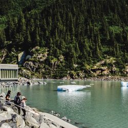
Portage Glacier Recreation Area – Access via a 5 mile/8 km paved highway. Three U.S. Forest Service campgrounds with more than 64 camping spaces are located approximately a mile apart on the Portage Glacier Road: Beaver Pond Campground, Black Bear Campground, and Williwaw Campground. The road ends at a large parking lot overlook at the western end of Portage Lake with excellent views of the icebergs floating in the lake.
Begich Boggs Visitor Center – Open from Late May to mid September, 7 days a week. 907-783-2326. Forest Service Naturalists describe the many phenomena associated with the glacier. A self-guided trail begins south of the visitor center. During July and August you can see spawning salmon in nearby Portage Creek.
Portage Glacier is one of Alaska’s most accessible and frequently photographed glaciers. Icebergs, weighing many tons, are blown about on Portage Lake (600 ft. deep), creating an ever-changing panorama of weather-sculptured blue ice.
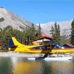
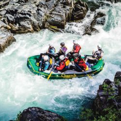
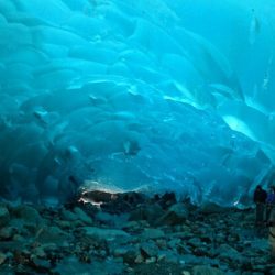
Whittier – The gateway to beautiful Prince William Sound, is only 63 miles from Anchorage. It is accessible by car, bus or via the Alaska Railroad. There are a number of great tours available in Whittier. Below are three we recommend.
www.whittierchamber.com
78.4
Placer River, large parking area.
77.8
Placer River overflow. Parking area at south end of bridge
75.5
Scenic view, parking on both sides of highway.
75.2
Ingram Creek. Fishing.
74.5
Large parking area. (northbound)
72.5
Parking. (northbound)
71.4
Parking. (southbound)
71.2
Parking. (southbound)
70.9
Parking. (northbound).
69.2
Scenic viewpoint.
68.3
Turnagain Pass Recreation Area (elev. 988 feet). Parking with view of Turnagain Pass. Restrooms and emergency phone.
66.8
Parking.
65.5
Bertha Creek.
65.4
Bertha Creek Forest Service Campground. 12 camp sites, water, overlook benches, toilets, firepits. Handicap accessible. Fee area.
65.3
Parking
64.8
Spokane Creek.
63.8
Johnson Pass trailhead.
63.3
Granite Creek bridge.
62.9
Granite Creek Campground. 19 camp sites, water, toilets, and tables. Fee area. Open early June – to Labor Day.
62.2
Granite Creek Recreation Area. 19 campsites suitable to RVs and tents. Water, tables, toilets, picnic tables, and fire pits.
61.7
East Fork Sixmile Creek.
61.1
Silvertip Creek.
59
Parking with Info sign.
58.5
Parking.
57.7
Parking with scenic view.
56.7
Canyon Creek, rest area both sides of highway at north end of bridge tables, toilets and hiking and biking trails.
56.3
Hope Junction. Hope is reached by a 16-mile paved road.
55.3
Parking. (northbound)
54.8
Parking. (northbound)
53.5
Parking with info signs. (southbound)
52.8
Parking. (northbound)
51.4
Parking. (northbound)
50.6
Scenic viewpoint. (northbound)
47.8
Lower Summit Lake. Parking.
47.3
Parking, good photo spot.
46
Colorado Creek.
45.9
Tenderfoot Creek Forest Service Campground, 35 campsites, water, toilets, tables and firepits, on east shore of Upper Summit Lake-good spring and fall fishing for small, Dolly Varden. Emergency phone. Fee area.
45.8
Summit Lake Lodge, services.
45.4
Scenic view with parking on the shores of Summit Lake. (northbound)
44.5
Parking at end of lake. (northbound)
43.7
Parking. (northbound)
42.2
Quartz Creek.
39.5
Devil’s Creek Trailhead. Part of Resurrection Pass Trail System. 10 miles to Forest Service recreational cabin and main trail between Hope and Cooper Landing (mile 56.4).
38.3
Parking with Scenic view beside Jerome Lake. Info signs and fishing. Stocked lake.
37.7
North Junction. Seward Highway and Sterling Highway. Southbound traffic can exit here for the Sterling Highway to Soldotna, Kenai and Homer.
37.1
Scenic view overlooking Tern Lake. (Southbound only)
37
South Sterling Highway entrance.
33.1
Carter Lake Trailhead, parking and toilets. Well-defined but steep trail leading into alpine country. Good trout fishing in Carter Lake and grayling fishing in east end of Crescent Lake. Trail is sometimes quite wet.
32.6
Johnson Pass Trail, parking.
32.5
Parking.
32.4
The Trail Lakes Fish Hatchery produce sockeye, coho, and Chinook salmon for release at selected sites throughout the Cook Inlet watershed. Open 8-5 daily.
31.7
Upper Trail Lake, parking, tables. Steep access
29.5
Moose Pass. A small community with camping, lodging, fishing guides and a general store. Al local landmark is the waterwheel with grinder.
25.5
Lower Trail Lake, parking.
25.3
Trail River bridge.
25
Falls Creek.
24.2
Trail River Forest Service Campground. 91 camp sites, water, toilets, tables, and playground. Fee area. Access via 1.2-mile side road. Lake trout fishing in Kenai Lake; rainbow and Dolly Varden all summer in river. Kenai Lake extends 24 miles from mouth of Snow River to head of Kenai River to west.
23.2
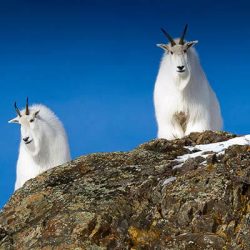
Ptarmigan Creek Forest Service Campground. 16 camp sites, picnic area, water, toilets. Good family trail follows creek to Ptarmigan Lake-7 miles, round trip. There is a good chance of spotting sheep and goats. You will find fair grayling fishing in outlet of lake, good rainbow and Dolly Varden in stream about one mile below the outlet. Fee area.
23.2
Ptarmigan Creek.
22.6
View of Kenai Lake, 24 miles long. A sign explains how this lake gets its color from the glacial melt. There are several parking areas along Kenai Lake.
21.4
Parking good view of Kenai Lake.
19.7
Victor Creek Bridge and Trail; limited parking.
17.7
Snow River. Glacial stream crossed by three consecutive bridges.
16.9
Primrose Landing Forest Service Campground. 7 small sites at upper end of Kenai Lake, water, tables, toilets. Handicap accessible. One mile side road. Fee area. Primrose Trailhead. Fishing.
14.7
Parking. Wildlife viewing platform. (northbound)
13.2
Grayling Lake trailhead, parking. Fishing for grayling.
12.4
Parking with scenic view. (norhbound)
12.1
Rest area at Troop Lake. Fishing
11.3
Parking. Golden Fin Lake trailhead. Fishing at Golden Fin Lake.
10.5
Large parking area. (northbound)
8.1
Parking. Chugach National Forest, East Boundary.
6.6
Bear Lake Road.
6.5
Bear Creek.
6.3
Stoney Creek Road
5.9
Salmon Creek, good fishing for sea-run Dolly Varden beginning in August.
5.4
Lost Lake Trail (7.3 miles one-way), turn west into Lost Lake subdivision. Follow signs to trailhead. This is a scenic trail with spectacular views of surrounding mountains and high alpine terrain.
3.5
Road to Exit Glacier in Kenai Fjords National Park approximately nine miles on good road. You can drive within 1/2 mile of the face of the glacier. Please use caution near the glacier as ice falls can be deadly.
3.2
Nash Road.
3.0
Resurrection River, 3 bridges.
2.6
Seward Airport.
2.4
Municipal campground.
2.0
U.S. Army and Air Force Recreation Resorts. RV parking and tent sites, cabins. For retired or active military only.
Seward Chamber of Commerce Visitor Center is open daily in the summer at mile 2 of the Seward Highway. Rest rooms, brochures and maps are available. 907-224-8051
1.3
Parking, memorial to Benny Benson, who designed the Alaska State flag.
1
Small boat harbor.
0
Seward. Seward is one of Alaska’s oldest and most scenic communities. Abrupt mountain slopes cloaked in shaggy summer greens and snow form an impressive backdrop for this progressive city of 2,700 people. Tourism, shipping and fishing are the mainstay of Seward’s economy.
Seward Chamber of Commerce Visitor Center
Open daily in the summer at mile 2 of the Seward Highway. www.seward.com

