The Steese Highway (Alaska Route 6) extends 162 miles/260 km from Fairbanks to Circle, a community on the Yukon River just 50 miles below the Arctic Circle.
The first 44 miles/71 km of the route are paved and the remainder is a good gravel road.
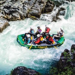
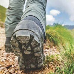
A number of wilderness hiking and canoe trails along the route are maintained by the Bureau of Land Management. These include the Chatanika River Canoe Trail (28 miles long), the Pinnell Mountain National Recreation Trail (24 miles), and the Birch Creek Wilderness Canoe Trail (150 miles). The following log gives trail access points. If you intend to hike or canoe along any of these trails, be sure to obtain detailed information and maps from the Bureau of Land Management, Fairbanks District Office, 1150 University Avenue, Fairbanks.
Updates on Road Conditions and Construction: http://511.alaska.gov
For a complete list of Things to do in Alaska, visit our Things To Do section. For information on places to camp, visit our section on camping in Alaska. To determine when you should plan your trip to Alaska, visit our page on the best time to visit Alaska. Finally, many visitors to the north want to experience the Aurora (Northern Lights), so we’ve put together a page of detailed information on how and when to see the Northern Lights.
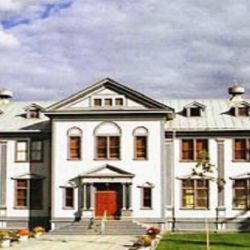
The Morris Thompson Cultural and Visitors Center. The 9,000 square-feet of interpretive space features exhibits on the land, the seasons and the peoples of Interior Alaska and the Arctic. www.explorefairbanks.com
1College Road-Bentley Mall.
2Junction of Old Steese Hwy.
2.7Farmer’s Loop Road and Birch Hill Recreation Area.
5Junction with Chena Hot Springs Road, which extends 57 miles/91 km to Chena Hot Springs Resort.
6.5Viewpoint of Fairbanks.
7Good view of pipeline.
9.4Goldstream Road.
11Fox junction. Gas, meals, groceries. The town is named for Fox Creek and is the site of a mining camp founded in 1905.
The Gold Dredge 8 can be found near Fox, and I would recommend a stop to see this incredible piece of equipment. There are informative tours and a chance to pan for gold. At mile 9/km 14.5 on the Old Steese Highway near the Alaska Pipeline viewpoint. From the junction the Elliott Highway (Alaska Route 2) branches off to Livengood (gas, groceries), an old gold rush camp about 70 miles/km 112.6 from here. The road continues on past Livengood another 87 miles/140 km to Manley Hot Springs (gas, groceries, rooms, meals). The White Mountain Summer Trail (23 miles long) begins at mile 27 on the Elliott Highway. The first part of the trail extends eastward over Wickersham Dome, a popular 4-hour round trip hike from the highway trail ends at Beaver Creek (excellent grayling fishing) where there is a public use cabin (Borealis-LeFevre) available on a reservation basis and for a fee. Another public use cabin is located at mile 62 on the Elliott Highway and can be reached by car. For detailed maps and cabin reservations, contact the BLM office in Fairbanks. Tolovana River Campground is located at mile 57 on Elliott Highway and has 6 camp sites. 13.5NOAA Command and Data Acquisition Station. The station is one of two in the U.S. responsible for tracking and commanding the nations’ environmental and weather satellites. Several large antennae are employed to downlink environmental data, which provides the nation with information for its weather forecasts, search & rescue capabilites and ozone monitoring. Visitors can learn about the methods and equipment used to operate the satellites, as well as look at how and why the data is distributed. Tourists who call ahead can coordinate their visit to the tracking schedule in order to watch the whole process in action. Tours are available. Call 907 451-1200 for more information.
13.8NASA Spaceflight Tracking & Data Network Station.
16.5Parking. Monument to Felix Pedro, who discovered gold on Pedro Creek in July 1902.
17.7Parking.
19.6Parking.
21Cleary Summit, 2,233 ft., is a ski area in winter. This is an excellent spot (along with summits at mile 85 and mile 110) to watch the summer solstice (June 21). During this period, the “midnight” sun never sets. On a clear day, the summit also affords good view of Tanana Valley and Mt. McKinley to the south, and the White Mountains to the north.
23Good view of abandoned mining town of Cleary, across the valley, parking.
27.9Chatanika. Site of old gold mining camp. Tailing piles-gravel and boulders unearthed and left behind by giant dredges-are mute evidence of a gold field that once produced millions of dollars. For the next 30 miles, the highway parallels the Chatanika River-grayling, northern pike, whitefish, sheefish.
27.9Old F.E. Company Camp.
28.7Abandoned Gold Dredge, reached by short walk over tailing piles.
39Upper Chatanika River State Site. 25 camp sites in timbered area, 4 picnic sites, water and toilets. Fishing for grayling. There is a road to a gravel bar which is the access point for Chatanika River canoe trail, it terminates at mile 11 on the Elliott Highway. There are many canoe trail access points along the Steese Highway. A good trip is from mile 66 (uppermost access point) to mile 39-see mile 66 for description.
43Hiking Trail to Nome Creek, 15 miles.
44End of Pavement.
47Camp Creek Road. Access point for Chatanika River canoe trail to the north, 1/4 mile.
51Grouse Creek, short trail leads from highway.
57.5U.S. Creek Picnic Ground. Tables, firepits, no toilets. Giant pipe running through picnic ground was once part of an 83-mile-long system of pipes and ditches which transported over 3 million gallons of water per hour to gold mining dredges near Fox at mile 11 on the Steese Highway.
58Upper Nome Creek Road. 4-wheel drive vehicles only.
59 Cripple Creek. Public use cabin is available only during fall, winter, spring, on a reservation basis. Contact BLM in Fairbanks for reservations. 60Cripple Creek Campground. 21 large camp sites with picnic tables and firepits, walk-in tent camping area, firewood, nature trail. Cripple Creek bridge and access point for Chatanika River canoe trail.
66Miracle Mile Roadhouse. Farthest upstream access point to Chatanika River canoe trail. The Chatanika is rated as a class 2, medium difficulty, stream. There are no major obstacles, but canoeists should watch for low overhanging trees (called sweepers), log jams, and fast white water. The Steese Highway parallels this stream for 28 miles and there are many access points from the highway. One possible trip is from this point (mile 66) to mile 39 at the Chatanika River Campground.
A longer trip is possible by continuing downstream to mile 11 on the Elliott Highway, or perhaps onto Minto Flats, to the Tolovana River, and then upstream 10 mile to the village of Minto. The BLM brochure, “Alaska Canoe Trails,” gives more details. 69Faith Creek Bridge, private RV Park, gold panning.
81Highway Maintenance Camp.
85.6Hiking Trail. Access point to Pinnell Mountain National Recreation Trail. This trail is 24 miles long and traverses ridge-tops above 3,500 ft. Although quite steep and rugged in many places, the trail is well marked. Trailheads are at mile 85.6 and mile 107.3 on the Steese Highway.
86Twelve Mile Summit. 2,982 ft. Located 12 miles from a group of mining claims on Birch Creek. From late July to mid-September, large herds of migrating caribou cross the highway between here and Eagle Summit at mile 108.
101Eagle Creek Roadhouse.
101.5Ptarmigan Creek Bridge.
107.3Hiking Trail. Access point to Pinnell Mountain National Recreation Trail. See information at mile 85.6 for a description of the trail.
108Eagle Summit. 3,624 ft. Highest of three summits on highway. Around June 21, weather permitting, 24 hrs. of sunlight fall on this peak. Wild flowers grow in profusion here. This area was prospected for gold 2 years before the 1898 discovery of gold in the Dawson City region.
114Side roads rough, leads to mining areas, and should be attempted only if you have 4-wheel drive.
116Mammoth Creek Bridge. Fossil remains of many species of pre-glacial Alaskan mammals have been excavated here.
119Bedrock Creek Campground. 5 camp sites, firewood, untreated water from creek.
127Central. This small community has post office, BLM fire station, meals, lodgings, groceries, gas, campground.
128Junction. Circle Springs and Arctic Circle Hot Springs Resort (8 miles), Circle City is (34 miles). Ketchum Creek Campground is at mile 6 on the road to Circle Springs.
147Birch Creek Bridge. Take out point for Birch Creek canoe trail.
162Circle. Post office, store, cafe, gasoline. Circle Public Campground is maintained by residents of Circle. Access to Yukon River.
