416.3
Houston. The population of Houston is approximately 3,200. Elevation 594m/1,949 ft. Travel Info Center at km 416.3
411
Rest area on east side of Bulkley River; tables and toilets.
399.7
Hungry Hill Summit. 844 meters/2769 ft.
394.8
Rest area; tables, toilets
372.2
Bulkley View Rest area; picnic tables, toilets.
368
Ft. Telkwa RV Park.
367.5
Tyhee Lake Provincial Park, 59 camp sites, day-use area, showers, toilets. Beach, interpretive trail and wildlife viewing platform. Boat launch and sani-dump.
367
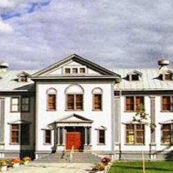
Telkwa. Population 1350. All visitor facilities are available in this quiet northern town. The museum, located in the schoolhouse in the center of town is packed with Telkwa’s history. At the west side of town is Eddy Park on the Bulkley River.
356
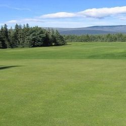
Riverside Recreation Center. RV Park and Par 3 Golf.
355.5
Driftwood Canyon Provincial Park. day-use area, toilets, self-guiding interpretive trail and viewing platform.
Driftwood Canyon is recognized as one of the world’s most significant fossil beds.
355
Bulkley River.
352
Smithers. Population 5,400. Elevation 496 meters/1627 ft.
350
Smithers Golf Club.
347
Smithers airport.
343
Rest area.
337
Toboggon Creek Fish Hatchery. Visitors welcome.
329.5
Trout Creek.
321
Stop of Interest at Moricetown Canyon. Moricetown is a First Nations community of the Wet’suwet’en People who have thrived in northern BC for centuries. The high canyon on the Bulkley River provides great views of the canyons and also great fishing. You may be able to watch a local fisherman use either fly rods or gaff poles to fish in the canyon.
309
East Boulder Creek.
304
Parking.
303
Parking.
301
Parking, picnic tables overlooking Bulkley River.
299.8
Parking.
287.5
Ross Lake Provincial Park, day-use area. Toilets, boat launch, hiking trails. Fishing, swimming and canoeing. 4 km side road.
285.5
Parking with info sign.
285
The Hazeltons, Travel Info Center. Population is approximately 1,358. Elevation 306m/1,004 ft.
Robber’s Roost Motel – Enjoy Spectacular views. Free, high-speed wireless internet, comfortable beds, Great rates, In-room coffee, Refrigerator, Microwave. All rooms are non-smoking. 3476 Laurier St., BC. 250-842-6916.
277
South Hazleton.
274.5
Seeley Lake Provincial Park. 20 campsites, picnic sites, water, swimming, fishing. Fee area.
258
Parking; Historical Plaque on Skeena Crossing. First Nations Kitsequecla Village. Many Totems are scattered throughout the village still in their original locations..
245
Parking.
241
Kitwanga Junction. Junction of Cassiar Highway 37 (north to Stewart, BC; Hyder, Alaska; and Watson Lake, Yukon).
237
Price Creek.
235.2
Parking.
232.7
Boulder Creek West.
232
Large rest area; picnic tables, toilets. Nice picnic spot.
227
Whiskey Creek.
226
Parking.
225.2
Gull Creek.
220
Coyote Creek.
218
Parking by Skeena River.
213.7
Flint Creek.
208.5
Viewpoint, parking. Historical plaque on Skeena riverboats.
206
Hells Bells Creek.
201
Parking.
195
Big Oliver Creek.
193
Little Oliver Creek.
187
Legate Creek.
181.4
Rest area overlooking Skeena River; tables, toilets and water.
179.5
St. Croix Creek.
174
Chimdemash Creek.
170
Usk was virtually wiped out during the Skeena River flood of 1936. The village is served by one of the few reaction ferries in BC, locals from both sides of the Skeena make the crossing by ferry. The tiny roadside chapel built as a replica of one which was destroyed in the flood.
166.3
Kleanza Creek Provincial Park. 32 camp sites, group site, picnic tables, pump for drinking water. Access via 1 km/.6 mile paved side road. 24-hour security, gate controlled. Features canyon with cascading waterfalls, hiking trail to top of canyon with view point and intermediate kayaking. Handicap accessible. In the day use area there are horseshoe pits, basketball, and a checker board. Trout fishing.
166
Kleanza Creek.
163.6
Small parking area.
157
Copper River Bridge.
155
Parking, “Welcome to Terrace” tourist info sign.
151
Junction with Highway 37 to Kitimat (59km/36 miles) and Airport (5km/3 miles). Lakelse Lake Provincial Park, 19 km/12 miles, has 156 campsites, log house picnic shelters, drinking water, flush toilets, showers, boat ramp, swimming, fishing, dump station.
150
Skeena River Bridge.
149.8
Ferry Island Campground.
147
Terrace. Travel Info Center on Keith Avenue Pop 12,000 elevation 70 m/210 ft.
