454
Fort Nelson. Population 5,900. Fort Nelson is a thriving community with an economy historically based on forestry, oil & gas, and an emerging tourism sector.
Fort Nelson Visitor Info Centre
Stop by to pick up a free copy of the Northern Rockies Travel Guide or ask the travel advisors for more information about travel in Northern BC. www.tourismnorthernrockies.ca


458
Old Alcan Highway loop road rejoins the Alaska Highway at km 468. Also access to Poplar Hills Golf Course – 9 holes, driving range, open daily.
467.4
Old Alcan Highway loop road rejoins the Alaska Highway at km 458. Also access to Poplar Hills Golf Course – 9 holes, driving range, open daily.
483.5
Highway 77 Junction, Liard Highway to Fort Liard and the Mackenzie Highway to Fort Simpson. It is a good gravel highway. The highway was officially opened in June of 1984. Check current road conditions at the Visitor Info Centers in Fort Nelson BC or Fort Simpson, NWT. Gas is limited with facilities at Fort Liard at 170 km/105 miles and at 394 km/245 mile junction of MacKenzie Highway.
495.3
Raspberry Creek
509
Kledo Creek.
509.3
Parking with litter bins
513.8
Muskwa River Park. Turn on Kledo Forest Service Road and drive to the end of the road. 5 rustic camping sites, boat launch and picnic area. The road is narrow (single lane) and can be rough as it is not maintained. Not recommended for large vehicles.
516
Steamboat Creek.
526
Large level parking area
533.2
Parking with view of Muskwa River Valley.
535.2
Parking
536.6
Steamboat Mountain Summit. 3,500 ft. Rest area, toilets.
545.2
Parking with view of Indian Head Mountain
548.9
Parking off highway with large turn around area. Teetering Rock hiking Trail.
551
Tetsa River Regional Park, 2 km side road. 25 sites, water, toilets and firewood. Fishing for grayling & Dolly Varden, in the Tetsa River. Fee area.
573
Parking alongside Tetsa River.
576
Parking with litter barrel.
579
Parking
584.6
Parking. Tetsa River Bridge #1. Tetsa #1 Trailhead.
586
Parking with Litter barrel.
587.3
Tetsa River Bridge #2.
590.3
Dunedin Trailhead
596.3
Parking with litter barrel.
597.7
Summit Lake (Stone Mountain) Provincial Campground, 28 camp sites, water, tables, boat launch, hiking trails. Fee area. Highest point on the Highway – 4,250 ft. Summit Peak trailhead
Flower Springs Trail starts just south of Summit Lake Campground. This trail takes hikers through lowland bogs and over glacial moraines, left from retreating glaciers, before reaching your destination at Flower Springs Lake. This is one of the most popular hikes in the region because it has amazing views and is moderately easy. It is 13.6 km round trip via the lake trail and 10.2 km round trip via the tower trail.
600.6
Parking. Brake Check
601.4
Erosion Pillars to the north, hard-rock cores left by erosion, parking. 1 km hike to see erosion pillars
602.2
Large parking area.
604.2
The Cut Trail. 6 km hike follows an older section of the Alaska Highway. Considered fairly easy.
605.2
Baba Canyon trailhead. Trail is 5.5 km round trip to the first viewpoint, 11 km to the second.
607
Large parking area.
614.4
Parking, access to Wokkpash Creek hiking trail, 15 km to Wokkpash Lake.
614.5
113 Creek and trailhead
616.5
115 Creek, wayside and rest area, tables, toilets, no drinking water.
628
McDonald River.
638.6
Stringer Creek bridge.
641
Racing River, parking at south end of bridge. Fishing for grayling and Dolly Varden.
647.4
Toad River Lodge (HM 422).

648.8
Parking with litter barrel.
658.6
Parking, information sign on geological formations of Folded Mountain. Tectonic deformations have folded the limestone giving these mountains their unique appearance
664.8
150 Creek.
668.4
Parking beside Toad River. Information sign on flash floods.
671.7
Toad River bridge. There are several small parking areas along this section of highway.
678.6
Peterson Creek named for Pete Peterson, a local trapper and big game guide, who came to the area in 1933. Pete Petersen was one of the few early white residents of the Muncho lake area and was instrumental in helping to refine the proposed route for the Army Core of Engineers. His story is mostly undocumented but he was a very well known trapper, guide and explorer. Many of the local landmarks bear his name such as Mt. Petersen overlooking Muncho Lake and Petersen Creek.
679
Peterson Trailhead.
680.5
Parking with litter barrel.
687.4
Large Parking area with view of Sawtooth Mountains.
695
Muncho Creek.
698
Red Rock Canyon
Muncho Lake
Driving along the shores of this massive jade green alpine lake is oddly reminiscent of Jasper National Park before the crowds. Muncho has a rich history, as it presented a considerable challenge during the original US Military construction of the highway. With the help of First Nations guide, Charlie McDonald, a safe route was plotted along the shoreline. To learn more about the area’s history the book, The Mcdonald’s: The Lives & Legends of a Kaska Dena Family by Alison Tubman is a fantastic read.
A stretch of the original route has been preserved and can be hiked or mountain biked. Canoeing and paddling Muncho Lake is also a favorite pastime with rentals available at local businesses. Lodging, camping and a small resort provide easy staging points to further explore this historic and awe-inspiring area.
There are many small parking areas alongside Muncho Lake.
701
Strawberry Flats Provincial Campground. 15 camp sites on the shore of Muncho Lake, tables, toilets. Old Alaska Hwy Trail & Viewpoint Trail starts from Strawberry flats Provincial Campground or 3km north (trailhead located along lakeshore). Hikers and Mountain bikers have an early climb as they ascend to the viewpoint trail but are soon rewarded with fantastic views of the lake below. The trail is wide, however, one brief single-track section, will challenge novice mountain bikers. The route is approximately 4 km long.
704.4
Parking, stop of interest with information panels, wildlife viewing.
708
Northern Rockies Lodge (HM 462)

709
MacDonald Campground, Muncho Lake Provincial Park. 15 camp sites on the shore of Muncho Lake, water, toilets. Fee area.
712.2
Viewpoint of Muncho Lake. Litter barrel. Information signs on the Muncho Lake and Alaska Highway Construction. Historic Mile Marker 463.
717
Parking with litter barrel
727
Hiking. There is a good chance you will see stone sheep in this area. Numerous natural mineral licks are found in the gullies near the highway.
729
Rest Area with restrooms, park information, litter barrels. Brake check.
733
Trout River Bridge. Grayling, whitefish. Flies and small spinners are best.
736.4
Parking by Trout River. There are several small parking areas between here and km 750.
737.7
Prochniak Creek. There is a trail to the west which leads to the high alpine.
740.5
Parking by Trout River
751
Parking area with garbage.
763
Lower Liard River Bridge. This major northern river drains the eastern slopes of the Rocky Mountains and flows across the northern plain of British Columbia to empty into the Mackenzie River. The Liard, the Peace and Athabasca rivers, were natural water highway for the Fur Traders.
764.7
Liard River Hot Springs Provincial Park, water, toilets, firewood and day-use area. Natural hot springs, bathing pools, change houses at both pools, boardwalk connecting both pools, amphitheater, playground, horseshoe pits, wheelchair accessible. Enjoy a walk along the boardwalk to the mineral pools. This is a very busy park during the summer. Visitors are warned to watch for signs of bear and please don’t leave food out.
792.5
Smith River, large parking areas at both ends of bridge. Grayling, Dolly Varden. Smith River Falls, 1.5 mile gravel side road leads to viewpoint overlooking Smith River Falls. There is a good 1/4 mile trail to base of falls. Good turnaround area but will be tight if you are towing.
811.5
Parking. View of Liard River
814
Large parking area with litter barrel.
822.7
Coal River Lodge.
823
Coal River Bridge.
831.7
Whirlpool Canyon. A short unpaved road leads to gravel parking. There are some basic campsites in the forest. A short trail leads to a viewpoint overlooking the Liard River. This section of the river is a narrow canyon with rapids.
839.5
Fireside
840
Parking area, view of Cranberry Rapids on the Liard River.
853
Parking on both side of the highway overlooking Liard River. Brake check
867
Parking.
880
Allen’s Lookout; large parking area with picnic tables, and views of Liard River.
905
Parking and Historic milepost 585 cairn. BC/Yukon Border, First Crossing. From here to the official BC/Yukon border crossing, the highway crosses the border 7 times.
909.4
Parking. Sign about U.S. Army Engineers, some working southward, others northward, met here on September 24, 1942, marking completion of the highway.
912
Contact Creek Lodge (HM 590)

914
Cosh Creek
917.3
Irons Creek
937
Hyland River, parking at north end of bridge. Fishing.
957
Lower Post, First Nations Village.
964.5
Parking with Welcome to British Columbia Sign.
968.5
Rest Area with point of interest signs on the 60th Parallel.
970.6
Rest Stop, toilets. Welcome to the Yukon sign. Access to Liard Canyon Recreation Site and Lucky Lake. Picnic area, waterslide, swimming, hiking and fishing.
978
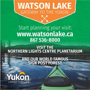
Watson Lake The first Yukon community encountered by the northbound traveler and the second largest town in the Yukon. It is a comfortable day’s drive from Fort Nelson or Whitehorse.
Alaska Highway Interpretive Center
The center provides information as well as an exceptional display of photos, and other audiovisual presentations. www.travelyukon.com


")
980
Junction with the Campbell Highway, which accesses the towns of Ross River and Faro. The Highway is 583km/362 miles and ends at the Klondike Highway, at Carmacks.
984
Watson Lake Government Campground, 4 km/3 miles access road, 55 camp sites, water, shelters, beach, boat launch, hiking trails, playground. Fee area.km 991.5/mile 616-Upper Liard River bridge. Fishing for grayling, Dolly Varden, lake trout, and northern pike in spring and fall.