1223
East boundary of Tetlin National Wildlife Refuge.
1223.4
Scotty Creek.
1224.8
Interpretive sign, parking, the Arctic Loon can often be seen in these marshes.
1225.5
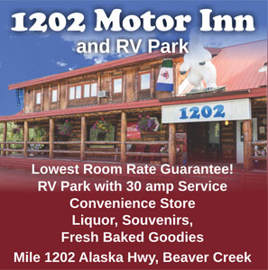
Border City Trading Post.
1228
Parking with information sign on “Corridors for Passage”.
1229
Tetlin National Wildlife is a dynamic landscape made up of forests, wetlands, tundra, lakes, mountains and glacial rivers bounded by the snowy peaks of the Alaska Range. This upper Tanana River valley has been called the “Tetlin Passage,” because it serves as a major migratory route for birds traveling to and from Canada, the lower 48 and both Central and South America. Many of these birds breed and nest on the refuge. Others pass through on their way to breeding and nesting grounds elsewhere in the state. Migrants, including ducks, geese, swans, cranes, raptors and songbirds, begin arriving in the valley in April, and continue into early June. An estimated 126 species breed on Tetlin during the short summer, when long days and warm temperatures accelerate the growth of plants, insects and other invertebrates, providing a ready source of rich foods for nesting birds.
Tetlin Refuge also supports a variety of large mammals. Dall sheep dot the higher slopes while moose feed upon the tender new growth that springs up in the wake of frequent lightning caused fires. Wolves, grizzly and black bears and members of three different caribou herds range over the refuge.
Arctic grayling, burbot, lake trout, northern pike and whitefish are present in refuge lakes and streams. No significant salmon runs reach this far inland.
As one of the only two road-connected Alaskan refuges, Tetlin has the unique opportunity of reaching nearly all the visitors who travel to the state via the Alaska Highway. Visitors from all over the United States and many foreign countries pass along Tetlin’s northern boundary every year. This gives the refuge an outstanding opportunity to provide interpretation about Alaskan habitats and the National Wildlife Refuge System. To meet this challenge, the refuge is an active participant in the Alaska Public Lands Information Center in Tok, and has a visitor reception center with interesting display at mile 1229.
For a complete list of Things to do in BC, the Yukon and Alaska on your trip north, visit our Things To Do section.
1233
Parking.
1234.5
Seaton Roadhouse Tertiary Trail. There are a series of trails maintained by the Tetlin Wildlife Refuge complete with observation decks and benches. There is a parking area, pavilion, and a toilet near the trailhead. Camping at designated areas along the trail.
1240
Parking, Hidden Lake Trail.
1240.2
The vertical culverts along the road were one of many attempt to prevent the permafrost from thawing and the road from falling apart.
1243.6
Scenic view, Information sign on “The Changing Landscape”.
1244
Visible to the north are the Mentasta Mountains, part of the Alaska Range.
1246.7
Gardiner Creek, parking at south end of bridge. Grayling fishing.
1247.8
Scenic view, parking.
1249.5
Deadman Lake Public Campground. mile 1249 has 15 campsites (4 sites are suitable for large RV’s) firepits, toilets, picnic tables, boat ramp, no drinking water. There is a self-guided 1⁄4 mile Taiga Trail walk at the campground. Canoes & lifejackets are available to use on Deadman Lake. During the summer, Ranger lead wildlife programs are conducted Monday through Friday at 7pm.
1250
Rest area.
1252.2
Parking with Information sign on the “Solar Basin”.
1256
Lakeview Public Campground. 8 camp sites, boating, fishing.
1263.5
The Chisana River (shoe-san’-ah) parallels the highway.
1264
Northway Junction, visitor facilities. 7 mile/11 km side road to Northway-groceries, motel, gas, camping. The Community is made up of approximately 400 people, mainly Athabascans. Northway was named after the late chief Walter Northway, who passed away in 1993 at the age of 117.
1269
Scenic view of Tanana River, parking with Information sign on “Highways of Water”. 100 yards upstream the Chisana and Nabesna Rivers join to form the Tanana (tan’-nah-naw) River.
1272.9
Parking with Information sign “Ponds are not Forever”.
1274
Parking.
1284.7
Parking.
1289
View of Midway Lake.
1289.4
Rest Area with bathrooms. Scenic view, turn around limited for RV’s towing vehicles. Interpretive sign.
1292.4
Parking area with scenic view
1293.8
Parking.
1301.7
Tetlin Junction.
(Taylor Highway to to Chicken and Eagle. The Taylor Highway is part of the Top of The World Highway, which connects to Dawson City, Yukon. Chicken is 66 miles from the Junction. Eagle 161 is miles/259 km. Dawson City is 174 miles/280 km. The Taylor Highway is the north end of the 500 mile/800 km “loop highway” which takes you through Dawson City, Yukon. The south end of the loop connects with the Alaska Highway at mile 925/1488 km near Whitehorse. See The Top of the World Highway.
1302.6
Parking, loop road rejoins highway at mile 1303.
1303.3
Tanana River bridge. Rest area at both ends of Bridge. Boat launch
1308.5
Weigh station and turn-off to U.S. Coast Guard LORAN-C station.
1308.8
Parking.
1309.3
Tok River State Recreation Site. 1309 Alaska Highway has 27 campsites, picnic areas, hiking trails and drinking water. Suitable for large RVs. 1309 Alaska Highway.
1309.4
Tok River Bridge.
1312.6
Tok Dog Mushers Association, track and grounds. The Tok Race of Champions Sled Dog Race is held annually each March.
1312.8
Vitus-Tok Make the Vitus Energy Convenience store at Tok your first and last stop in Alaska.
1314
Tok Alaska. Tok is often referred to as the “Gateway to Alaska,” because it is the first major community in Alaska you come to when heading north. The Alaska Highway also intersects here with the Glenn Highway
Tok Mainstreet Visitor Centre
There is statewide information for your entire trip planning needs and is also home to a museum & gift shop. www.tokalaskainfo.com


1314.8
Northern Energy

1325.7
Tanacross Junction.
1330.1
Scenic view.
1330.7
Parking.
1332
Moon Lake State Recreation Site. 17 camp sites, tables, water, toilets, boat launch, good swimming, beach. A nice spot but camp sites are small.
1333.6
Yerrick Creek. Parking.
1338.1
You will cross Cathedral Creek three times in the next mile.
1342.2
Sheep Creek.
1344.6
Rest area.
1347.4
Robertson River Bridge.
1350.5
Scenic view; parking.
1353.6
Jan Lake Road.
1357.5
Bear Creek Bridge, parking.
1358.7
Chief Creek, parking.
1361.3
Dot Lake. Headquarters for Dot Lake Native Corp.
1370.1
Scenic view, parking.
1371.4
Berry Creek, parking. Grayling fishing, small spoons or flies are best.
1374.3
Sears Creek, parking.
1378
Dry Creek.
1379
Parking, good view of surrounding mountains on a clear day. Pay phone
1380.5
Johnson River Bridge.
1381
Parking, trail to Lisa Lakes.
1383.9
Craig Lakes-turn south on old highway bypass to sign marking location of half-mile trail. Fishing for trout.
1385
Parking, Tanana River access, boat launch.
1388.4
Little Gerstle River. Parking
1391.7
Parking.
1392.5
Black Veterans Memorial Bridge over the Gerstle River.
1393
Rest area.
1401.1
Parking.
1403.8
Sawmill Creek.
1411.7
Scenic view, parking.
1414.8
Clearwater State Recreation Site, 8.5 miles northeast on Jack Warren loop road, travels through the extensive farmland of the Delta Junction area. It rejoins the Richardson Highway at mile 268, just north of Delta Junction. 15 camp sites, water, toilets, boat launch. Grayling fishing in Delta-Clearwater River. Fee area.
1422
Delta Junction Alaska, Delta Junction marks the true end of the Alaska Highway. This is the junction of the Alaska and Richardson Highways. You will be travelling on the Richardson Highway to Fairbanks, if you are continuing North.
Delta Junction Visitor Center
Stop in for comprehensive information and souvenirs from the gift shop. Certificates for completing the Alaska Highway are available. www.deltachamber.org/visitorcenter.html
The Road Log Continues below from Delta Junction to Fairbanks on the Richardson Highway.
You can see the full Richardson Highway Road Log here.
266.3
(Richardson Highway Mileage) Delta Junction Post Office.
267
Delta Junction Airstrip.
267
Delta State Recreation Site. 25 camp sites, water, tables, toilets, picnic shelters, Fee area.
268
Smith’s Green Acres RV Park
268.3
Clearwater State Recreation Site on Jack Warren Road, 11 miles km on good road. Campground has 17 camp sites, picnic area, tables, toilets, water and boat launch. You can continue on this road 8.5 miles to the Alaska Highway mile 1415/km 2277.
275
Tanana Trading Post and Tesoro Gas station to South side of highway. Big Delta State Historical Park and turn off to Rika’s Roadhouse on North side of highway.
Rika’s Roadhouse at Big Delta State Historical Park. The Valdez-to-Fairbanks trail brought travelers to the banks of the Tanana River, where they crossed by ferry. John Hajdukovich, a Yugoslavian entrepreneur, bought the land along with a fur trading post in 1909 making the Roadhouse over 100 years old. The two-story roadhouse, built of logs became a year-round oasis for hunters, trappers, prospectors and travelers as well as local Athabascans and homesteaders. However, John had many other interests, including the responsibility of US Game Commissioner. Sitting still and running a roadhouse did not appeal to him so he simply asked guests to make themselves at home and leave some money on the table. He ran it in this way until 1918, when finally a dependable, hard-working Swede named Rika Wallen was hired to take over. earn more of this fascinating story by visiting the Roadhouse, refreshing yourself at the Restaurant and enjoying the gift shop.
275.4
Big Delta Bridge and Trans-Alaska Pipeline Bridge elevated 40 ft. above the Tanana River, this 1200-ft. bridge is the second longest on the route. (The longest crosses the Yukon River north of Fairbanks). Good view of the Alaska Range to the south. Large parking area at east end of bridge.
277.8
Quartz Lake State Recreation Area, access via 3-mile side road. 87 camp sites, Facilities include two boat launches, a handicap accessible fishing dock, picnic sites, a picnic shelter, swimming area, beach volleyball court, water, and toilets. Stocked with rainbow, trout and cohoe. Boat recommended. Fee area. There are 12 camp sites at Lost Lake. Facilities include picnic area, water and toilets. Lost Lake is not stocked but its small picnic area is a favorite spot for those who want to enjoy the area’s scenery and wildlife.
280.4
Parking.
286.7
Shaw Creek. Large parking area and boat launch good early spring and fall grayling fishing. Picnic table. View of Mt. Deborah (12,339 ft.) to the west, Mt. Hayes (13,832 ft.) to the southwest and Mt. Hess (11,940 ft.) between the two former peaks. All are a part of the Alaska Range which spans southcentral Alaska in a sweeping 600-mile arc.
288
Parking with Scenic view.
289.7
Parking.
294
Parking.
295.3
Banner Creek, historic placer gold stream.
296.5
Parking with view of Tanana River.
297.6
Scenic view, parking on west side of highway. Access road to Tanana River.
298.2
Parking.
304.3
Parking.
305.2
Birch Lake State Recreation Site is reached by turning north onto the gravel road for 1/4 mile. 17 camp sites, picnic area, toilets, swimming. Boat launch, excellent rainbow and trout fishing (boat recommended).
306
Rest area beside Birch Lake. Toilets.
310
Parking.
313
Parking.
321.5
Harding Lake State Recreation Area is a highly developed recreation area 45 miles southeast of Fairbanks (1.5-mile side road to campground on north side of Harding Lake) off the Richardson Highway. Harding Lake, is one of the few natural lakes near Fairbanks that can be reached by road, it is a favorite spot to swim, boat and fish. There are 90 camp sites for vehicles, a walk-in group camping area, toilets, water and dump station. There is also a large picnic and beach area with dressing rooms, a baseball field, volleyball court, horseshoe pits and campfire area. Resident ranger. Pike and lake trout. Harding Lake was a brief stopover for Will Rogers & Wiley Post on their ill-fated flight to Barrow, Alaska. Be sure to bring along your mosquito repellent!
322.2
Salcha River Lodge.
323.3
Salcha River State Recreation Site. 130 sites, boat launch, picnic area, toilets and water. Fishing for grayling and king salmon is good in the Salcha River. Fee area.
324.5
Parking.
324.8
Munsons Slough and parking at south end of bridge.
325.5
Community of Salcha.
327.7
Little Salcha River.
342
Eielson Air Force Base Main Gate.
Built in 1943. Named for Carl Ben Eielson, famous Alaskan bush pilot.
343.5
Moose Creek Road
344.7
Moose Creek.
346
Chena Flood Channel.
346.7
Laurance Road. Chena Lakes Recreation Area.
349.5
Badger Road is a 12 mile loop which rejoins the Richardson Highway at mile 357.
349.4
North Pole Alaska. Home to the Famous Santa Claus House.
357
Badger Road is a 12 mile loop which rejoins the Richardson Highway at mile 349.5.
359.7
Business Route. Leads to Cushman St. and downtown Fairbanks.
360.6
bypass via the Mitchell Expressway to the Parks Highway to Denali National Park.
364
Alaska’s second largest city and has a population of 32,000 and a Borough population of almost 100,000, including the nearby military bases. Fairbanks is the hub for Alaska’s Interior and Arctic with first-class accommodations and restaurants, museums, world-renowned concerts and performances, upscale galleries and specialty stores, historic sites, Alaska Native culture, and access to the Alaskan wilderness.
The Morris Thompson Cultural and Visitors Center
The 9,000 square-feet of interpretive space features exhibits on the land, the seasons and the peoples of Interior Alaska and the Arctic. www.explorefairbanks.com
Accommodations & Camping


Things to Do in Fairbanks