364
Fairbanks. Alaska’s second largest city has a population of 32,000 and a Borough population of almost 100,000, including the nearby military bases. Fairbanks is the hub for Alaska’s Interior and Arctic with first-class accommodations and restaurants, museums, world-renowned concerts and performances, upscale galleries and specialty stores, historic sites, Alaska Native culture, and access to the Alaskan wilderness.
The Morris Thompson Cultural and Visitors Center
The 9,000 square-feet of interpretive space features exhibits on the land, the seasons and the peoples of Interior Alaska and the Arctic. www.explorefairbanks.com
Accommodations & Camping
Things to Do in Fairbanks
360.6
Bypass Fairbanks via the Mitchell Expressway to the Parks Highway to Denali National Park.
359.7
Business Route. Leads to Cushman St. and downtown Fairbanks.
357
Badger Road is a 12 mile loop which rejoins the Richardson Highway at mile 349.5 in North Pole.
349.5
North Pole Alaska.
349.5
Badger Road is a 12 mile loop which rejoins the Richardson Highway at mile 357.
346.7
Laurance Road Exit. Access for Chena Lakes Recreation Area.
346
Chena Flood Channel.
344.7
Moose Creek.
343.5
Moose Creek Road
341.8
Eielson Air Force Base Main Gate. Built in 1943. Named for Carl Ben Eielson, famous Alaskan bush pilot.
327.7
Little Salcha River.
325.5
Community of Salcha.
324.8
Munsons Slough and parking at south end of bridge.
324.7
Parking.
323.6
Clear Creek.
323.3
Salcha River State Recreation Site. 130 sites, boat launch, picnic area, toilets and water. Fishing for grayling and king salmon is good in the Salcha River. Fee area.
322.2
Salcha River Lodge.
321.5
Harding Lake State Recreation Area is a highly developed recreation area 45 miles southeast of Fairbanks (1.5-mile side road to campground on north side of Harding Lake) off the Richardson Highway. Harding Lake, is one of the few natural lakes near Fairbanks that can be reached by road, it is a favorite spot to swim, boat and fish. There are 90 camp sites for vehicles, a walk-in group camping area, toilets, water and dump station. There is also a large picnic and beach area with dressing rooms, a baseball field, volleyball court, horseshoe pits and campfire area. Resident ranger. Pike and lake trout. Harding Lake was a brief stopover for Will Rogers & Wiley Post on their ill-fated flight to Barrow, Alaska. Be sure to bring along your mosquito repellent!
317.9
Parking.
313
Parking with info sign on Tanana Valley.
310
Parking.
306
Rest area beside Birch Lake. Toilets.
305.2
Birch Lake State Recreation Site is reached by turning north onto the gravel road for 1/4 mile. 17 camp sites, picnic area, toilets, swimming. Boat launch, excellent rainbow and trout fishing (boat recommended).
304.3
Parking.
298.2
Parking.
297.6
Scenic view, parking on west side of highway. Access road to Tanana River.
296.5
Parking with view of Tanana River.
295.3
Banner Creek, historic placer gold stream.
294
Parking with information signs on the Gold Rush Centenial.
289.7
Parking loop road.
288
Parking with Scenic view.
286.7
Shaw Creek. Large parking area and boat launch good early spring and fall grayling fishing. Picnic table. View of Mt. Deborah (12,339 ft.) to the west, Mt. Hayes (13,832 ft.) to the southwest and Mt. Hess (11,940 ft.) between the two former peaks. All are a part of the Alaska Range which spans southcentral Alaska in a sweeping 600-mile arc.
280.4
Small gravel parking area.
277.8
Quartz Lake State Recreation Area, access via good 3-mile side road. 87 parking and camping sites. Large RV’s can park at the camping sites in the parking lot development. Facilities include two boat launches, a handicap accessible fishing dock, picnic sites, a picnic shelter, swimming area, beach volleyball court, water, and toilets. Stocked with rainbow, trout and cohoe. Boat recommended. Fee area.
There is a trail connecting Lost Lake and Quartz Lake. There are 12 camp sites at Lost Lake. Facilities include picnic area, water and toilets. Lost Lake is not stocked but its small picnic area is a favorite spot for those who want to enjoy the area’s scenery and wildlife.
275.4
Big Delta Bridge and Trans-Alaska Pipeline Bridge over the Tanana River. This 1200-ft. bridge is the second longest on the Richardson Highway (The longest crosses the Yukon River north of Fairbanks). Good view of the Alaska Range to the south. Large parking area at east end of bridge.
275
Tanana Trading Post and Tesoro Gas station to South side of highway. Big Delta State Historical Park and turn off to Rika’s Roadhouse on North side of highway.
The Valdez-to-Fairbanks trail brought travelers to the banks of the Tanana River, where they crossed by ferry. John Hajdukovich, a Yugoslavian entrepreneur, bought the land along with a fur trading post in 1909 making the Roadhouse over 100 years old. The two-story roadhouse, built of logs became a year-round oasis for hunters, trappers, prospectors and travelers as well as local Athabascans and homesteaders. However, John had many other interests, including the responsibility of US Game Commissioner. Sitting still and running a roadhouse did not appeal to him so he simply asked guests to make themselves at home and leave some money on the table. He ran it in this way until 1918, when finally a dependable, hard-working Swede named Rika Wallen was hired to take over.
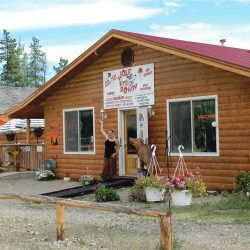
Learn more of this fascinating story by visiting the Roadhouse, and refresh yourself at Rika’s Roadhouse Café and Gifts. It is open from mid May to early September. The Café serves homemade soups, sandwiches, pies and baked goods. The Smiling Moose Gift shop specializes in Alaskan-made gifts, souvenirs, and food items, and offers unique, locally made ulus, knives, fur items, books, photography, wall art and much more. Free admission to the park! 907-895-4201
268.3
Clearwater State Recreation Site on Jack Warren Road, 11 miles km on good road. Campground has 17 camp sites, picnic area, tables, toilets, water and boat launch. You can continue on this road 8.5 miles to the Alaska Highway mile 1415/km 2277.
268
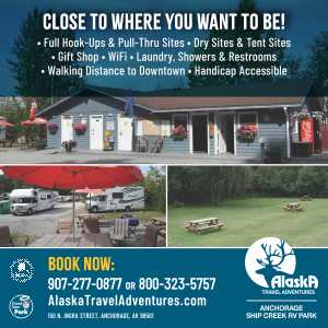
Smith’s Green Acres RV Park
267
Delta State Recreation Site. 25 camp sites, water, tables, toilets, picnic shelters, Fee area.
267
Delta Junction Airstrip.
266.3
Delta Junction Post Office.
266
Delta Junction Alaska, Junction of the Richardson and Alaska Highway. Delta Junction marks the true end of the Alaska Highway. Turn left if you are southbound for Tok on the Alaska Highway or stay to the right for Glennallen and Valdez on the Richardson Highway.
Delta Junction Visitor Center
Stop in for comprehensive information and souvenirs from the gift shop. Certificates for completing the Alaska Highway are available. www.deltachamber.org/visitorcenter.html
265
Jarvis Creek.
262.6
Scenic view, handicap accessible toilets.
261
Fort Greely.
258.3
Alyeska Pipeline Pump Station No. 9. No tours available.
257.6
Meadows Road, entrance to U.S. Army Cold regions Test Center at Fort Greeley.
252.9
Rest area.
246
Donnelly Dome to the west, elevation 3,910 ft.
245
Donnelly Lake.
243.9
Parking, good views (on clear day) of Alaska Range, and peaks Deborah, Hess, and Hayes, to the south.
243.5
Parking with view of pipeline.
242.3
Weasel Lake. Stocked with Rainbow Trout.
241.3
Scenic view; parking.
238
Donnelly Creek State Recreation Site. 12 camp sites along loop road, water and toilets, firepits and hiking trail. One of the state’s most scenic campgrounds, with views of some of the tallest peaks in the Alaska Range. The Delta bison herd can often be seen from nearby viewpoints and from the campground.
234.7
Ruby Creek, parking.
234.5
Parking.
233.2
Bear Creek, parking
231
Darling Creek, parking.
230.5
Parking.
229.5
Parking with great views.
228.3
One Mile Creek.
227.4
The Black Rapids Roadhouse. Established in 1902 on the original Valdez-Fairbanks Trail. The new lodge has a restaurant and accommodations.
227
Gunny Sack Creek, parking.
225.4
Parking, picnic tables on right southbound. Trail opposite historical sign leads 1/4 mile to Black Rapids Lake, it is stocked with rainbow. Historical sign describes rapid advance of Black Rapids Glacier. During the winter of 1936, this mile-wide, 300-foot-high river of ice advanced an average of 115 ft./day, or over 4 miles, to within 1/2 mile of the highway. It has been receding ever since.
224.8
Upper Suzy-Q Creek, parking.
224.5
Lower Suzy-Q Creek, parking.
223.7
Boulder Creek, parking.
223
Whistler Creek, parking.
220.8
Flood Creek, parking.
219.9
Michael Creek, parking at both ends of bridge. Good view of Pump Station No 10.
219.1
Pipeline Pump Station No. 10.
218.8
Trims Creek, parking at north end of bridge.
218
Highway Maintenance Camp, no services.
217.1
Castner Creek, small parking area at both ends of bridge.
217
Parking.
216.8
Lower Miller Creek, parking at south end of bridge. Pipeline crosses the river above ground.
216
Parking area to view pipeline.
215.2
Parking; pipeline crosses Miller Creek. Interpretive signs with Pipeline information.
214
Scenic view; parking.
212
Parking.
208.4
Parking.
207
Parking.
206.2
Scenic view; parking.
203.9
Parking.
202.4
McCallum Creek.
202
Pipeline parallels the highway.
201.4
Phelan Creek.
200.5
Fielding Lake State Recreation Site. Access via 2-mile side road. A scenic campground at an elevation of 2,973 feet in the Alaska Range. The ice on the lake often remains until July. The 17 site campground is rustic but has picnic tables, toilets, and a bulletin board with information about the area. Boat launch and fishing. The boat launch provides access to some excellent fishing. The fish population is all natural and not stocked. Arctic Grayling, lake trout and burbot are all found in Fielding Lake. No fee and no water. There is a public use cabin which is available by reservation.
197.6
Parking; scenic view. Monument to former Alaska road commission director, Captain Wilds P. Richardson, for whom the highway is named. Good view of Gulkana Glacier .
196.8
Gunn Creek bridge. View of Gulkana Glacier to northeast.
195
Summit Lake. Gulkana Glacier is visible for northbound travelers. Summit Lake is home to the annual Arctic Man Race. The race requires a skier to ski down a 4,000 ft slope, where they meet up with their snow machine partner to be towed behind on a rope at up to 80 mph uphill where they are dropped off at the top of the mountain and have to ski down again to the finish. This a famous and popular event.
There are several parking areas bordering Summit Lake between mile 191 and 194.
190.5
Parking by Gulkana River Salmon Spawning viewpoint. View of Summit Lake and pipeline. There is a trailhead across the highway.
189.5
Large parking area.
188.3
Rest area; tables, firepits, water, toilets.
188
Gulkana Hatchery. A state-owned hatchery established in 1973 with the goal of developing sustainable salmon fisheries for Alaska. Not open to the public.
185.5
Paxson Junction with the Denali Highway. This scenic, 135 mile/217 km route connects the Richardson Highway with Denali National Park and Preserve. The Highway begins at Paxson Junction on the Richardson Highway and ends at Cantwell Junction where it connects with the Parks Highway. The Denali Highway is closed from October to mid-May. This is a mostly gravel road and most rental car companies do not allow their vehicles to be driven on this road.
