185.5
Paxson Junction with the Denali Highway. This scenic, 133 mile/214 km route connects the Richardson Highway with Denali National Park and Preserve. The highway begins at Paxson Junction on the Richardson Highway and ends at Cantwell Junction where it connects with the Parks Highway. The Denali Highway is closed from October to mid-May. This is a mostly gravel road and most rental car companies do not allow their vehicles to be driven on this road.
182.1
Parking by Paxson Lake.
180
Parking.
179
Huffman Creek.
177
Parking.
175
Paxson Lake BLM Campground. Access by 3/4-mile gravel road. Large campground (50 camp sites) near lake with some pull-through sites, dump station, fire pits, boat launch and water available. Good fishing for trout, grayling and burbot. Fee area. Watch for bear.
173.2
Dick Lake to the east. Good view of pipeline. Grayling fishing.
171.5
Parking.
170
Meier’s Lake Roadhouse.
169.3
Large parking area. Middle Fork Trailhead to Meier’s Lake.
168.1
Gillespie Lake Trailhead and parking. Grayling fishing.
166.5
June and Nita Lakes one mile trail to the west. Quater mile trail to the west. Fishing.
162.2
Parking.
161
Haggard Creek.
160.8
Haggard Creek Trailhead, parking area. Access to Gulkana River, grayling fishing.
156
Parking.
153.5
Parking.
153
Parking.
150.7
Parking.
149
Parking.
147.2
Sourdough Roadhouse.
147.5
Sourdough Creek BLM Campground. 42 camp sites, toilets, boat launch. Handicap accessible. Fee area. Good fishing in Gulkana River.
147
Large parking area with views of the Alaska Range.
141.4
Large parking area.
140.7
Parking.
139.3
Parking.
138.2
Poplar Grove Creek.
136.9
Gulkana River Trail. Poplar Grove/Gulkana public fishing access trail. Steep gravel road access is not recommended for most RV’s. Informal camping in dirt parking lot. Fee area.
136.5
Coleman Creek.
132.3
Parking.
130
Parking.
128.5
Gakona Junction. Junction of the Richardson Highway and the Tok Cut-off. Here the Tok Cut-Off heads northeast 125 miles to Tok Alaska .
127
Gulkana.
126.8
Gulkana River Bridge, parking.
126
Parking.
118.5
Gulkana Airport.
118
Dry Creek State Recreation Site. 50 camp sites, picnic shelters, water, toilets, trails and fishing.
115
South Junction of Richardson and Glenn Highways. Here the Glenn Highway heads west 189 miles to Anchorage. The Richardson Highway continues 115 miles south to Valdez. If you’re heading towards Anchorage see the Glenn Highway description.
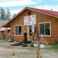
Hub of Alaska at the junction of Glenn and Richardson Highways. Produce, meat, ice cream, hot sandwiches, coffee, fishing tackle and licenses. Alaskan gifts and jewelry. ATM machine at the store. 907-822-3555
The Greater Copper Valley Visitor Center at the junction of the Richardson and Glenn Highways. Stop by for up-to-date info about the area.
112.5
Rest Area, Historical Marker. Commemorates Alaska Road Commission which began in 1905. Great view of the Wrangell Mountains, 4 major peaks: Mount Drum, Mount Sanford, Mount Wrangell and Mount Blackburn. mile 111.8 Copperville Road.
111
Tazlina River Trading Post.
110.7
Tazlina River Bridge.
110.6
Rest Area. Picnic tables and toilets beside the Tazlina River.
110.4
Tazlina River RV Park.
106.8
Wrangell St-Elias Park and Preserve Visitor Info Center
106.2
North Junction of Old Richardson Highway loop road leads to historic Copper Center. Copper Center is one of the oldest white communities in Alaska’s Interior. Founded as a government agricultural experimental station, it later served as a transportation center for the gold rush prospectors who came over the old Richardson Trail from Valdez enroute to the Forty Mile area and Dawson.
The George I. Ashby Memorial Museum, housed in rustic log cabins, the museum offers the visitor a unique look at the varied past of the Copper River Valley area. Exhibits include early mining of gold and copper, and Russian artifacts.
101.6
Brenwick Craig Road. Access to The Copper River Princess Wilderness Lodge .
101
Klutina River Bridge. Parking. The Klutina River has good runs of both Alaska King salmon and the world famous Copper Red salmon. The Klutina-Gulkana Rivers offer some of the state’s best fishing.
100.2
South Junction of Old Richardson Highway loop road leads to historic Copper Center and returns to the highway at mile 106.2.
90.7
Parking by Willow Creek.
88.6
Viewpoint; Pipeline parallels highway.
87.7
Parking by Willow Lake. Good views of Wrangell Range, over 50 miles away. Mt. Drum (12,010 ft.) is nearest peak. Mt. Wrangell (14,163 ft.) is semi-active volcano east of Mt. Drum. Mt. Sanford (16,237 ft.) is partly hidden by these two mountains and Mt. Blackburn (16,390 ft) the tallest of the four major peaks. The Wrangell Range takes in an area of over 5,000 square miles, and has 12 peaks above 10,000 ft. Innumerable glaciers drain northward into the Tanana and Yukon river systems which flow into the Bering Sea. Glaciers also drain southward into the Copper and Chitina river systems which empty into Prince William Sound and the Pacific.
83
Parking at Pippin Lake.
82.6
Junction with The Edgerton Highway. Branch Road to the small community of Chitina (33 miles) and into the Wrangell St. Elias National Park to the ghost towns of Kennecott and McCarthy (60 miles past Chitina) This takes approximately 3 hours to drive and the road can be quite rough. The first 33 miles to Chitina are paved. Liberty Falls Campground, with 6 units, grayling fishing, is located 24 miles from this junction.
Chitina (pronounced CHIT-na) has a population of around 200. Its beautiful scenery, dilapidated buildings and fishing in nearby lakes and streams are it’s main attractions. 2 miles from Chitina across the Copper River is a camping and picnic area. Chitina became prominent about 1910 as a railroad and mining supply center, after completion of the Copper River and Northwestern Railway from the coastal town of Cordova to the world-famous copper mines at Kennecott. The road from Chitina to McCarthy follows the path of the old railroad. This gravel road is state maintained from May 15 – September 15 and is passable by any standard passenger vehicle. There are no vehicle services beyond Chitina and the road is narrow in places. Check at the Ranger Station at Chitina for current road conditions. There is a footbridge across the Kennicott River. The town of McCarthy is a half mile beyond the end of the first bridge. Van transportation is available to Kennicott and McCarthy from the footbridge. Call Wrangell Mountain Bus 554-4411 from the pay phone at the bridge.
The “Company Town” of Kennecott and its support town of McCarthy sprang up in 1910 with the development of the massive high grade copper deposits at the Kennecott Mine and flourished until 1938 when the mine and railroad were abandoned. In 1986 the Kennecott Mine was named a National Historic Landmark. Today there are about 50 residents in Kennecott / McCarthy area.
80.8
Parking.
79.5
Squirrel Creek and Squirrel Creek State Recreation Site. 25 camp sites, water, toilets, firepits and fishing in creek. Fee area. Limited turn around space at end of road. If you are driving a large RV it is best to park near the entrance and walk to select your site. Road is fairly rough.
79.1
Tonsina River Bridge. Tonsina River and Little Tonsina River which parallels the highway from mile 74 to mile 65, has good Dolly Varden, salmon & grayling fishing.
74.5
Large parking area.
72
Parking with view of Alaska Pipeline.
65
Little Tonsina River.
64.7
Pump Station No. 12. This is the last of 12 pump stations located along the Alaska pipeline. No Public Access.
62
Ernestine Station. Highway maintenance camp-no public facilities.
60
Parking by Tiekel River. Fishing.
58.1
Wagon Point Creek.
56.2
Parking by Tiekel River.
56
Tiekel River Lodge.
55.1
Parking by Tiekel River.
54
Parking.
50.7
Tiekel River Bridge.
47.9
Large paved rest area by Tiekel River, covered picnic tables, toilets. Viewpoint and information sign for Mount Billy Mitchell.
46.9
Tiekel River Bridge and parking.
45.6
Stuart Creek, parking just north of bridge.
43.3
Large parking area.
42.2
Parking.
40.6
Parking.
37.3
Tsaina River Bridge and parking at south end of bridge.
34.5
Loop road parking
30.1
Parking area on both sides of highway a with good view of Worthington Glacier. There are several places to pull off over the next couple of miles and view this spectacular scenery.
29.1
Parking
28.7
Worthington Glacier and Worthington Glacier State Recreation Site. Viewing shelter with interpretive displays, picnic shelters, trails, and toilets (no overnight camping). Public telephone.
27.5
Good view of 27 Mile Glacier if you are heading towards Valdez.
26.8
Highway Maintenance Camp, no public facilities.
26
Thompson Pass. 2,678 ft. Historical sign sketches history of early-day travel on this route. Airstrip.
25.7
Parking with view. Keystone Glacier can be seen on a clear day.
25.5
Parking. Marshall Pass. During the winter of 1907 a 140-ft. steamboat was carried piece-by-piece on horse-drawn sleds to the Copper River, 31 miles east.
24.3
Parking.
24.1
Blueberry Lake State Recreation Site. Access by 1 mile side road. 25 camp sites, picnic shelter, water, toilets, and trails. Grayling and Rainbow trout in both lakes.
23.4
Parking with view.
23
Parking with view.
21.5
Parking.
19.5
Access to trail of ’98.
18.7
Sheep Creek.
18.3
Parking on both sides of highway, telephone.
16.4
Lowe River and bridge.
15.9
North end of Keystone Canyon.
15.4
Lowe River Bridge, parking at bridge. Historical sign.
14.8
Lowe River Bridge. Old Railroad Tunnel. Historical sign describes hand-cut tunnel started in 1905. This tunnel was described in Rex Beach’s novel, The Iron Trail.
13.9
Bridal Veil Falls, Keystone Canyon. Large parking area.
13.4
Horsetail Falls. Welcome to Valdez sign and area map, large parking area.
12.9
South end of Keystone Canyon.
11.9
Loop road that accesses the Pack Trail of 1899. Parking is better at the north end of the loop road.
11.6
Parking.
5
Salmonberry Ski hill
4
Parking beside Lowe River.
3.3
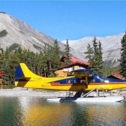
Robe Lake Road. Robe Lake Recreation Area. Floatplane base, and picnic area reached by 1/2-mile gravel road.
2.8
Dayville Road. leads 5.4 miles to Port of Valdez. extends to south side of Valdez Arm, tank farm and docks for the 800 mile-long Trans-Alaska pipeline. No public access.
2.4
Valdez Memorial Cemetery.
1.7
City of Valdez Gold Fields Complex.
1.2
Parking overlooking Wetlands
1
Chugach Forest pullout. Interpretive sign.
.9
Valdez Glacier Stream.
0
Old Valdez Town site. If you are heading towards Valdez continue straight ahead (4 miles) to the NEW City of Valdez, which was rebuilt after the devastating earthquake of 1964.
This marks the end of the Richardson Highway. It is 3.5 miles to the new town site of Valdez, Alaska.
3.4
Access road to airport (west) 1 mile. Valdez Glacier Campground (2 miles) 101 camp sites, water, toilets and fire pits. Fee area.
mile 2.2 Mineral Creek Loop Road returns to the Richardson Highway at mile 3.4. Access road to Port of Valdez and container terminal.
1.9
Parking.
1.2
Parking.
.9
Parking at Crooked Creek salmon spawning area. Observation platform. Chucagh National Forest Information Center.
.4
Parking with information Kiosk.
0
Valdez is a Year Round Playground and is a city that needs to be on every visitors list of must do’s. It has a spectacular mix of tidewater glaciers, forests and mountains unequaled in the State and offers incredible recreational opportunities throughout the year.
The Valdez Convention & Visitors Bureau
An excellent place to plan your stay in Valdez. Plenty of information on local attractions and activities. www.valdezalaska.org
Accommodations & Camping
Things To Do
