1403
Caribou RV Park

1419.4
Hi Country R.V. Park

1419.4
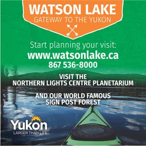
Whitehorse. South access to downtown via Robert Service Way. Whitehorse is The Capital of the Yukon and offers unparalleled access to the surrounding wilderness. Over two-thirds of the Yukon’s residents live in Whitehorse, which has a year-round population of about 36,000. For a complete list of Things to do in the Yukon and Alaska on your trip north, visit our Things To Do section.
Yukon Visitor Reception Centre
This is a great place to start your visit to Whitehorse as there are many staff available to answer questions and tons of information on the surrounding areas. www.tc.gov.yk.ca/vic.html


1422.3
Yukon Transportation Museum. This is a very interesting stroll through the Yukon’s past. You will see the “Queen of the Yukon,” Lindbergh’s sister airship, as well as many other types of transportation that helped open the early Yukon to modern times.

1422.3
Beringia Interpretive Centre.
")
1423
Airport Chalet.

1423
Whitehorse Airport.
1425.5
Two Mile Hill Intersection, north access to downtown Whitehorse. Turn down the hill to access Whitehorse city center.
1426.9
Kopper King
1428.2
McIntyre Creek.
1428.3
Fish Lake Road.
1437
Junction of North Klondike Highway to Dawson City. Take the Klondike Highway 6km to Takhini Hot Spring Road to access Yukon Wildlife Centre and Eclipse Nordic Hot Springs, a completely new facility at the site of the former Takhini Hot Springs..
1454.1
Viewpoint overlooking the Takhini River. Parking. There is an information sign on the old Dawson Trail, the stagecoach trail between Whitehorse and Dawson City.
1468.9
Takhini River.
1481
Annie Ned Creek.
1487
Takhini Burn rest area. Litter barrels, outhouse and viewing platform with information signs on the 1958 Takhini wildfires.
1489.1
Side road to viewpoint 3.2 km/2 miles, Takhini River Campground 15 km, Kusawa Lake campground 23 km/14 miles, gravel road is narrow and winding, camp sites.
1503.6
Mendenhall River
1534.8
Cracker Creek.
1546
Otter Falls visitor facilities.
1547.5
Aishihik River, Rest Area at east end of Aishihik bridge with view of Canyon Creek Bridge, originally built in 1920 to haul supplies to Silver City, it was rebuilt in 1942 during construction of the Alaska Highway The bridge was typical of the type of construction used on the Alaska Highway. It was rebuilt again in 1987 and the Yukon government refurbished it in 2005.
Aishihik Lake Campground 42 km/26 miles, camp sites, shelter, fishing. Aishihik road leads 29 km/18 miles to Otter Falls day-use recreation site. Picnic tables, kitchen shelters and boat launch. There is fly fishing for lake trout, grayling and rainbow below the falls. 17 km/11 miles beyond the falls is the southern end of 40 mile-long Aishihik Lake with boat launch and fishing for lake trout, grayling and northern pike. The road (which is maintained only as far as Otter Falls) continues on to the abandoned First Nations village of Aishihik, 135 km/84 miles (and is not recommended for large RV’s).
1562.5
Marshall Creek
1566.2
Rest Area.
1572.2
Pine Lake Public Campground. 42 camp sites, water, fire pits, shelters, swimming beach, excellent interpretive trial. Fishing and boating in nearby lake for lake trout, grayling, white fish, burbot and pike. Fee area.
1584
Rest area.
1578
Da Ku Cultural Centre and Haines Junction Visitor Center. Includes Native cultural displays.
1578.5
Haines Junction. Population 800, this highway community is nestled at the base of the St. Elias Mountains and is the headquarters for Kluane National Park.
Haines Junction is part of the Golden Circle Route. Take the Haines Highway 246 km/153 miles to Haines to continue on the Golden Circle Route.


1584
Rest Stop
1589
Trailhead.
1589.1
Parking.
1596.7
Spruce Beetle Trail, Rest Area.
1598.6
Bear Creek Summit. 1,004 meters/3294 ft. Highest point on the highway between Whitehorse and Fairbanks.
1608.5
Jarvis River, parking at north end of bridge.
1610
Rest Area.
1614.2
Sulphur Lake.
1628
Rest Area.
1630.4
Christmas Creek.
1633
Boutillier Summit. 1,003 meters/3290 ft. Second highest point on the highway between Whitehorse and Fairbanks. If you are heading North this is your first glimpse of Kluane Lake.
1635.5
Rest area, interpretive sign on the Kluane Lake and First Nations history.
1635.8
Turn east on gravel road for 5 km/3 miles to ruins of Silver City. This old trading post, with roadhouse and North West Mounted Police barracks was on the wagon road from Whitehorse to the gold fields of Kluane Lake.
1636.6
Silver Creek.
1642
Kluane Lake is 46 miles long is the largest lake in the Yukon. It is famed for its beauty and fishing. Huge waves are not uncommon on this lake, so if you are using a boat be careful and pay attention to the weather.
1642.1
Rest Area beside Kluane Lake.
1647.4
Slim’s River Bridge. Crosses ancient glacier moraine at head of Kluane Lake. Sheep Mountain, bordering highway is in Kluane National Park. Dall Sheep are often seen on hillside.
1648.9
Tachal Dhal Visitor Information Center. Rest area. Viewing platforms with telescopes for viewing sheep. Interpretive programs. Open mid-May to mid-September.
Slim’s River West trailhead adjacent to information center.
1662.5
Rest Area.
1666.1
Congdon Creek Campground has 103 sites, including 26 pull-throughs. Due to high grizzly bear activity, tenting is permitted only inside a fenced area. Open from May through Sept. Km 1666 Alaska Hwy.
1666.6
Congdon Creek.
1676.8
Nines Creek.
1677.5
Mines Creek.
1680.2
Bock’s Brook.
1684.4
Destruction Bay. Small highway community.
1684.5
Talbot Arm Motel. For over 45 years Talbot Arm Motel has served the traveling public. Open year-round it has 32 clean and comfortable motel units Satellite TV and Wi-fi, a full service dining room, cocktail lounge, groceries, liquor off sales and ice. Fas Gas, diesel, oil products and propane. Water, hot showers, Laundromat and clean rest rooms. Overnight RV parking and winter plug-ins are available. 867-841-4461
1685.1
Rest Stop on Cluett Creek.
1690.3
Lewis Creek.
1695.4
Copper Joe Creek.
1700.7
Kluane Energy Gas Station, Store & Café – Top Tier Gasoline, Café & Grocery Store. Good coffee and friendly Staff.

1700.8
Kluane Museum

1700.8
Rocking Star Adventures

1760
Dalan Campground.
1702.8
Burwash Airport.
1709.5
Duke River, flows into Kluane Lake; it was named for George Duke, a prospector in the area.
1717
Burwash Creek.
1724.7
Sakiw Creek.
1726
Kluane River, rest area.
1728.9
Quill Creek. Site of Hudson’s Bay Company nickel mine, the Wellgreen, which closed in 1973.
1739.7
Swede Johnson Creek.
1755.5
Rest area, toilets. Interpretive display. Mount Walsh is visible from here. Canada’s highest peak, Mount Logan (5957 m/19,545 feet), and Mount Kennedy, named for the late U.S. President, are obscured by intervening mountains.
1761.6
Donjek River Bridge. White volcanic ash is part of deposit ranging from Watson Lake to a point west of Alaska/Yukon border. Deposited over 14 centuries ago, it varies in depth from a few inches to over 300 feet.
1770.4
Parking.
1782.5
Edith Creek.
1783.1
Pine Valley Highway Lodge.
1791.1
Lake Creek Campground, toilets, tables and kitchen shelters. Fee area.
1802.1
Pickhandle Lake Recreational Site
1810.1
Koidern River Fishing Lodge.
1810.2
Koidern River. # 2.
1818
Discovery Yukon Lodging has cabins, full service RV sites and tent camping. This wilderness oasis offers a wide range of amenities for guests. Free Wi-fi hotspot at the main lodge, hot showers, beer & wine sales, an amazing bistro and they are pet-friendly.
1818.6
White River Bridge.
1832.4
Sanpete Creek.
1837.5
Dry Creek # 1.
1840.8
Rest area.
1841.9
Dry Creek # 2.
1849.3
Snag Road Intersection.
1849.6
Snag Junction Campground, 15 sites, toilets, tables, picnic shelter, fire pits. Fee area.
1858
Rest area.
1860.4
Enger Creek.
1870.6
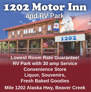
Beaver Creek Population 100
1202 Motor Inn & RV Park

1870.8
Day use picnic area.
1872.9
Rest Area.
1873.6
Beaver Creek Airstrip.
1873.8
Canada Customs and Immigration, open 24 hours a day year round. All traffic entering Canada must stop.