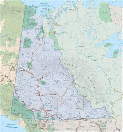
The Yukon is a land of breathtaking beauty, rich history, and untamed wilderness. The Yukon Territory is nestled between British Columbia in the South, Alaska to the west, The Northwest Territories to the east and the Beaufort Sea (Arctic Ocean) to the North.
Whether you’re an avid outdoor enthusiast, history buff, or simply in search of an unforgettable adventure, the Yukon offers an abundance of attractions and landmarks that will leave you in awe. We have maps of the entire Yukon Territory as well as it’s major towns and cities to help you get a feel for this incredible place.
If you want to plan your own custom Itinerary in the Yukon, try our Free Travel Planner
(The Travel Planner lets you choose any town or city you want to visit or select from pre-planned Yukon Routes like the Golden Circle or the Klondike Highway Loop)
British Columbia and the Yukon Territory:
The journey into the Yukon begins with its neighboring province, British Columbia. There are two routes through British Columbia that reach the Yukon. The most popular is the Alaska Highway, or Alcan. The second option is the Cassiar Highway. This is the slightly shorter route, but it is more remote and there are fewer towns along the journey. If you’re looking to explore the untouched wilderness of British Columbia, the Cassiar Highway a stunning drive. The Alaska Highway, made famous during it World War II construction is an amazing drive through history. There are many towns and cities in BC to stop and explore as well as regular highway lodges to take a rest and fuel up.
Stops of Interest in the Yukon and British Columbia
British Columbia
Dawson Creek – Mile 0 of the Alaska Highway
Fort St John – The largest city in the Peace River District
Fort Nelson – Heart of the Northern Rockies
Pink Mountain – Historic highway roadhouse with Fuel, food and camping
Toad River – Historic highway roadhouse with fuel food and camping
Northern Rockies Lodge – Beautiful lodge on the shore of Muncho Lake.
Liard River Hotsprings – A landmark on the Alaska Highway for 80 years.
Yukon
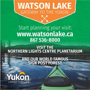
Watson Lake – The First community in the Yukon
Teslin – Home to the Teslin Tlingit People
Nisutlin Trading Post – A great spot to stop and fuel up with food and gas
Teslin Tlingit Heritage Centre – Discover the history of the Teslin Tlingit People
Whitehorse – The Capital of the Yukon
Dawson City – Home of the Klondike Gold Rush
Haines Junction – Gateway to Kluane National Park
Flightsee over Kluane National Park – a once in a lifetime experience
Beaver Creek – the most westerly town in Canada
Interactive Map of the Alaska Highway through the Yukon
Below is an interactive google map of the Alaska Highway showing camping, rest stops, attractions and more. You can also find our mile-by-mile highway log of the Alaska Highway here.
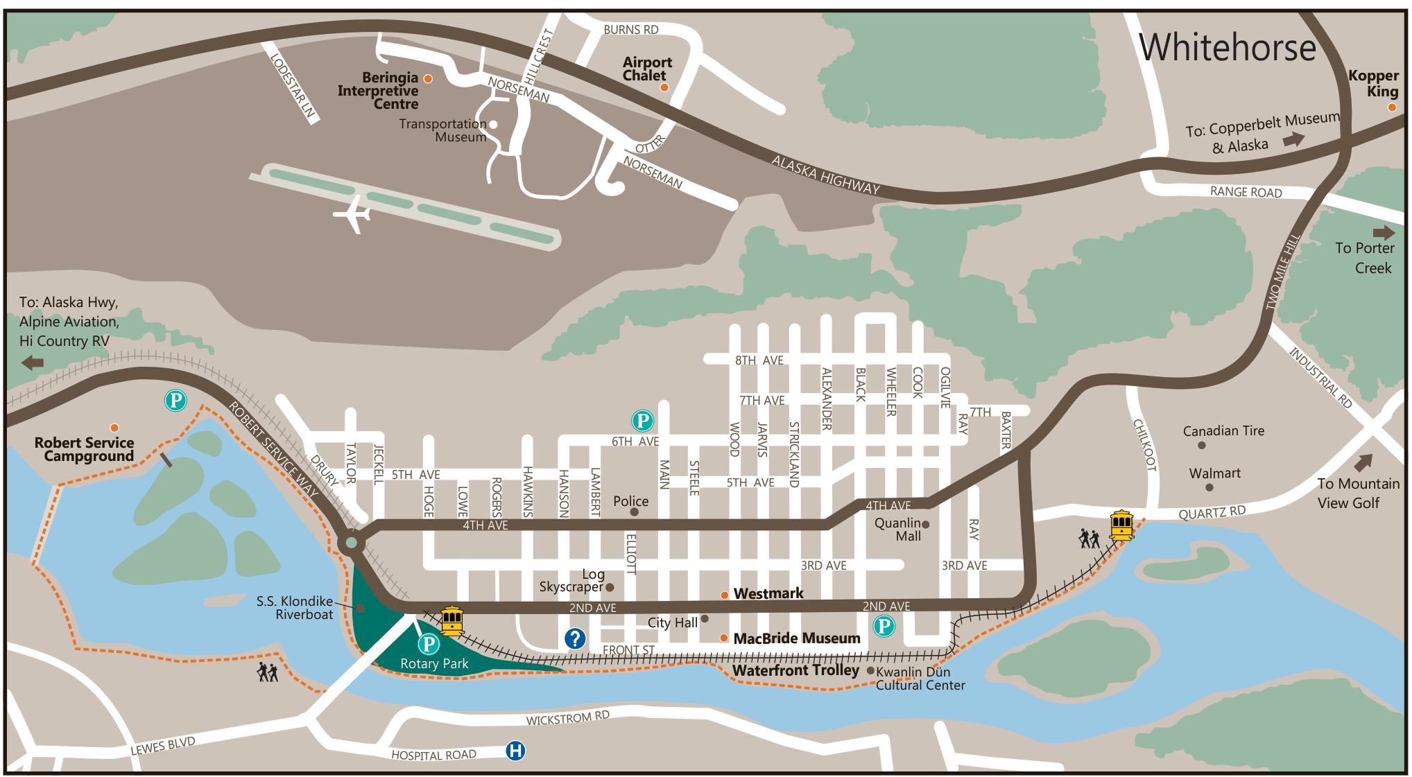
Whitehorse: The Yukon’s Capital City
Whitehorse is not only the Yukon’s Capital, it is also by far it’s largest city. Approximately 35,000 people live in Whitehorse and the entire population of the Territory is only 44,000. Whitehorse played a pivotal role in the Klondike Gold Rush as a supply centre. It remains a great city with excellent museums, camping, hiking, mountain biking, and cultural treasures.
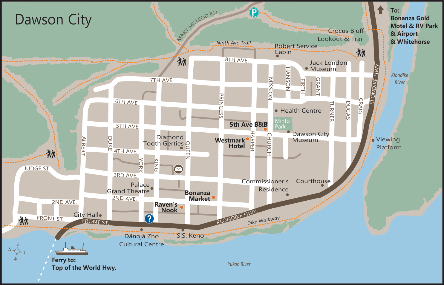
Dawson City: Gateway to the Klondike Gold Rush:
No exploration of the Yukon would be complete without a visit to Dawson City, a town steeped in history and intrigue. Once the epicenter of the Klondike Gold Rush, Dawson City still retains its authentic charm and serves as a windowinto the past. As you wander its streets, you’ll feel transported to the 19th century, witnessing the remnants of the gold rush era.
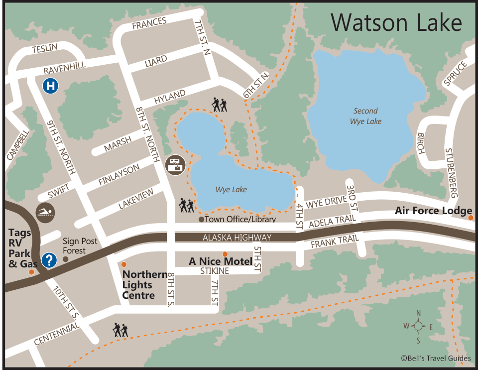
Watson Lake: Home of the world famous Sign Post Forest.
Watson Lake is the first major community your will encounter in the Yukon when heading North on the Alaska Highway. It has become famous for a collection of signs that now exceeds 80,000. Started by an American GI during the building of the Alaska Highway, the Sign Post Forest has continued to grow for almost 80 years.
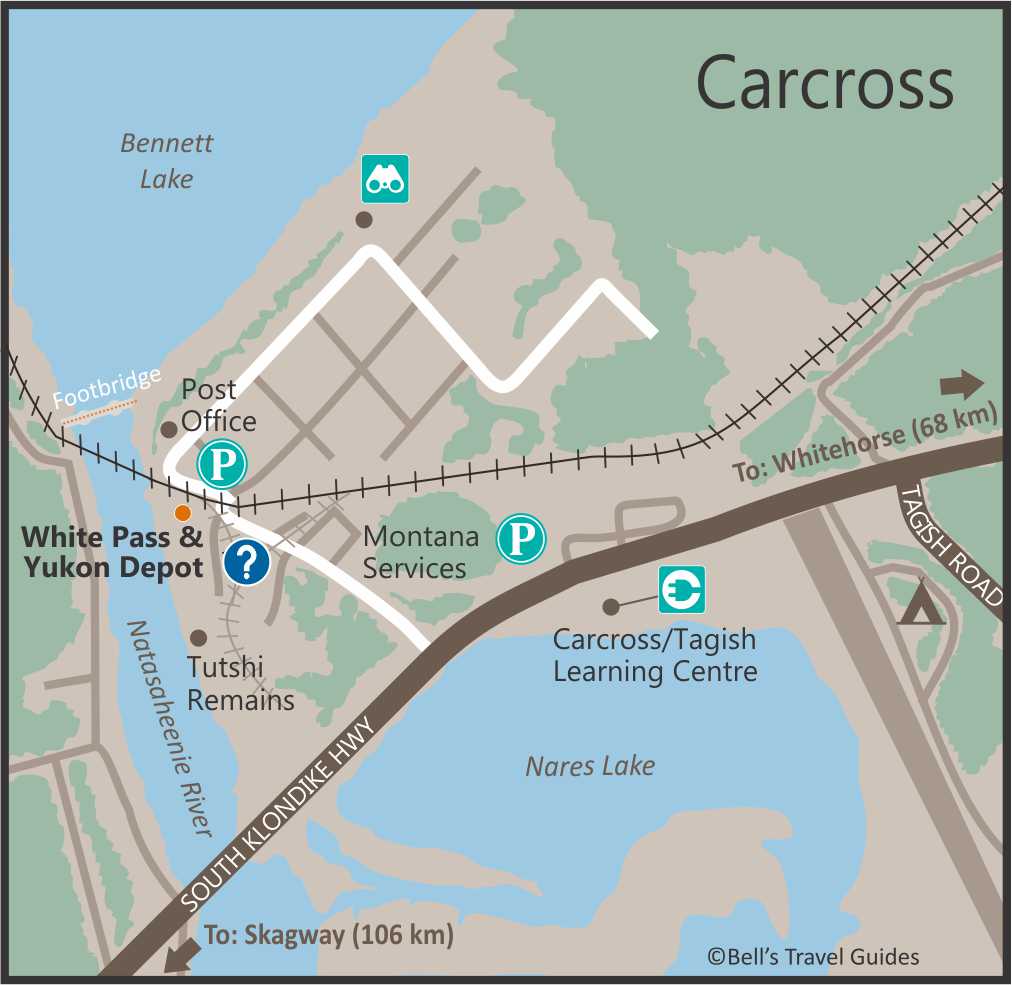
Carcross: Take the White Pass & Yukon Route Railroad
Carcross was another Yukon town that grew out of the Klondike Gold Rush of 1898. Gold seekers trekked over the Chilkoot Pass from Skagway to reach Carcross before building rafts to float down the Yukon River to Dawson City. This challenging journey prompted the building of the White Pass Railroad which took the lower White Pass route from Skagway to Carcross. The White Pass & Yukon Route Railroad celebrates it’s 125th year in 2023 and is one of the most popular tours in all of Alaska. Carcross remains a small village with a rich history. Many of the buildings in town have been standing for close to 100 years.
National Parks and Natural Wonders:
The Yukon is a haven for outdoor enthusiasts and nature lovers. Its vast expanse is home to several national parks, each offering unique landscapes and wildlife. Kluane National Park, a UNESCO World Heritage Site, showcases towering mountains, glaciers, and pristine lakes. Haines Junction, nestled at the foot of the St. Elias Mountains, provides access to unparalleled hiking and camping opportunities in Kluane National Park.
There are 2 more national Parks in the Yukon: Vuntut National Park and Ivvavik National Park, both of which are at the very north tip of the Yukon, making them extremely remote and difficult to visit.
Mount Logan and the St. Elias Mountains:
Rising majestically in the St. Elias Mountains, Mount Logan stands as Canada’s highest peak and a testament to the raw beauty of the Yukon. Adventure seekers can embark on expeditions to conquer its summit, while others can marvel at its grandeur with a flightseeing tour over Kluane National Park. The St. Elias Mountains offer a backdrop of awe-inspiring vistas and unparalleled wilderness.